Theme
Precision agriculture
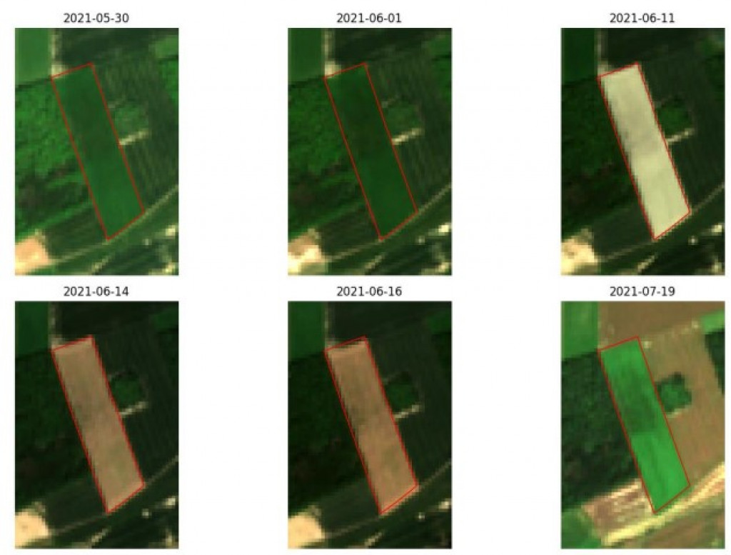

Sentinel satellites for agricultural monitoring
The SAGRIWASENT II project team at CRA-W is developing algorithms using SENTINEL satellite images to monitor agricultural activity in Wallonia.
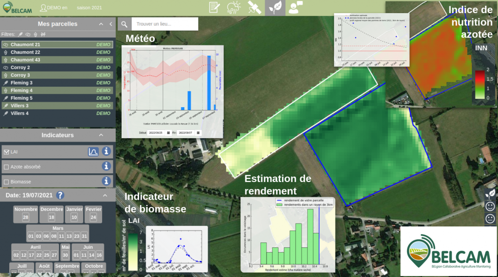
Best monitoring of agriculture plots by satellite
The BELCAM platform provides new products from satellite information to improve the management of agricultural plots.
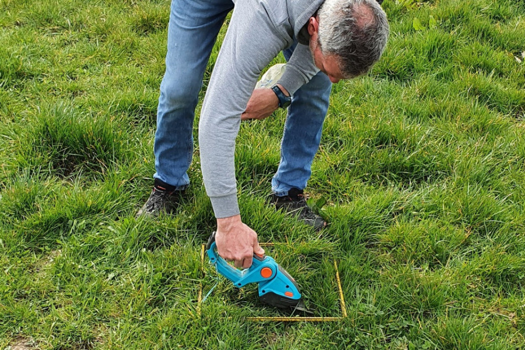
SUNSHINE: the Walloon grass growth observatory
Establishing a grass growth observatory in Wallonia based on an approach that combines field data, satellite data and growth models.
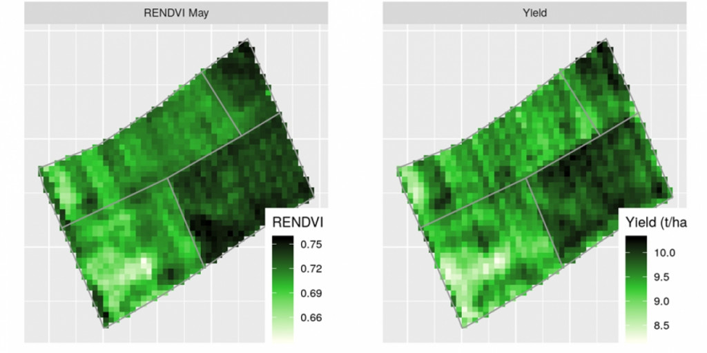
Stargate - TowardS an operaTionAl nitRoGen recommendation in potATo based on sEntinel-2
Following the BELCAM project, the STARGATE project aims to develop a methodology to determine the in-season potato nitrogen status using satellite images (Sentinel-2).
Can UAV’s help to improve nitrogen recommendation?
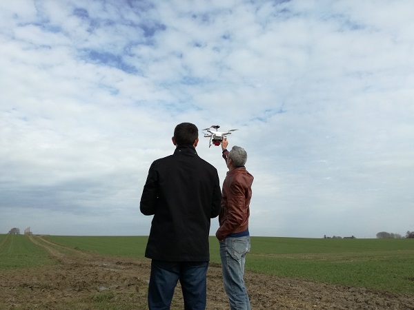
UAV images can be used to investigate soil organic content! This is one of the UAVSoil project objectives.
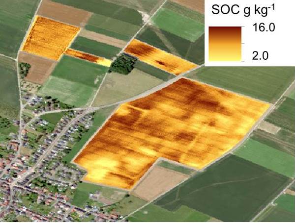
uavsoil - UAV borne spectrometers for high resolution soil and crop monitoring
The UAVsoil project (2017-2019) took place in a context of optimisation of agricultural management at field level through the use of images from sensors embedded on UAV to characterise...